Beyond Expectations
3 Things to Know About a Little Satellite with a Big Impact on Earth

By Michelle A. Monroe
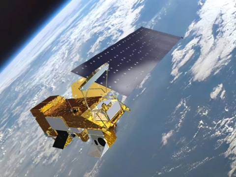
Two decades ago, Northrop Grumman built NASA’s Earth-observing satellite, Aqua. It’s been working flawlessly ever since, quietly orbiting the Earth every 98.8 minutes.
It was only supposed to last for six years.
“Aqua is a really amazing satellite,” said Northrop Grumman’s Deputy Operations Support Lead for Aqua, Madina Arman. “It has shown how Earth has changed and provides that data to scientists and decision-makers to help them understand climate change.”
Built by Northrop Grumman, Aqua is part of NASA’s Earth Observing System (EOS) program, designed to monitor the climate systems and their interactions through long-term global observations.
Here are three things to know about Aqua.

1.) Flying Through Decades of Success
Aqua was launched on May 4, 2002, from Vandenberg Air Force Base and has now completed more than 100,000 orbits of the Earth. Carl Martin, Northrop Grumman EOS program manager, said a spacecraft’s lifespan depends on the reliability of the hardware, redundancy of components and — most importantly — how you maintain and operate it. Northrop Grumman has been responsible for ensuring that Aqua is able to successfully perform its mission, and it’s outperformed all expectations.
“Aqua has been flying up there for about 20 years and has not had a major anomaly or failure. You’ve still got pretty much a brand-new satellite,” explained Carl, who began leading the program five years ago. “The science data would not be available if we didn’t take care of the propulsion system, the electrical power and everything else.”
Last year, NASA and the Department of the Interior presented the William T. Pecora Award to the Aqua mission team, which includes NASA employees and the Northrop Grumman Factory Support Team led by Carl and Madina. The award is presented annually to individuals or groups who have made outstanding contributions toward understanding the Earth by means of remote sensing.

2.) Helping Us Make Smarter Environmental Decisions
Aqua looks at Earth’s water cycle, from liquid ocean and lake water to soil moisture and snow. Its data are used along with numerical models to provide operational predictions of harmful conditions, such as along the California coast, allowing recreational managers, marine mammal rescue teams and others to make better-informed decisions. Aqua’s data have also been used to monitor air quality, forest fires and the condition of U.S. crops during the growing season.
In March 2023, scientists used imagery from Aqua to help spot more than 13 million tons of Sargassum, a yellowish-brown seaweed, drifting in the Atlantic Ocean. Floating Sargassum provides crucial environmental benefits for many marine species, such as shelter and breeding grounds for endangered sea turtles. Officials in eastern Florida and elsewhere along the Gulf Coast will use the data to plan for cleanup efforts when the seaweed comes to shore.
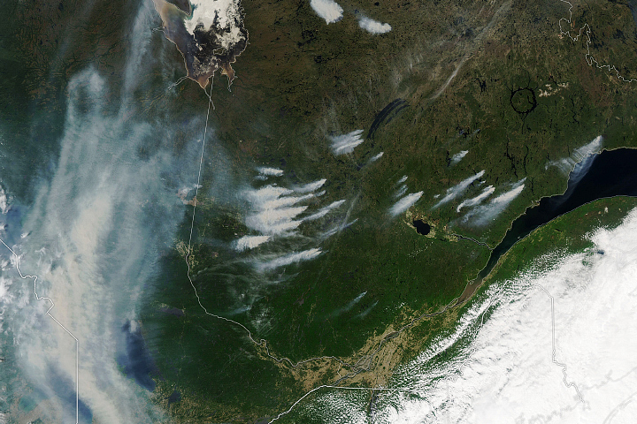
Even more recently, in June 2023, Aqua has been helping to track the devastating wildfires raging in Canada. The Moderate Resolution Imaging Spectroradiometer (MODIS) on Aqua has captured views of smoke billowing from the fires.
“Any data is useful data when understanding and combatting a wildfire,” said Madina.
Image Right: By June 2023, about 160,000 hectares had burned in the province of Quebec since the start of the year. Photo credit NASA, via Visible Earth.

3.) Providing Critical Disaster Relief Support
Aqua transmits real-time data through direct broadcast, which is available to anyone with an appropriate antenna and is captured and processed by over 200 ground stations worldwide. This allows immediate use of local data, which can be particularly important in times of disasters, such as forest fires or drought. Humanitarian agencies and national governments can take swift action because disaster relief mechanisms can be triggered earlier.
In 2015 and 2016, nearly $350 million of emergency water and food aid were delivered to Southern Africa, in part based on data from Aqua, to aid millions of people.
“I’m most proud of being involved with programs like Aqua because of the benefits it provides to humanity,” Carl said. “Being able to utilize Aqua’s data to support emergency relief, analyzing the impacts of climate change or even being able to provide pretty cool pictures of what Earth looks like, is always amazing to me.”
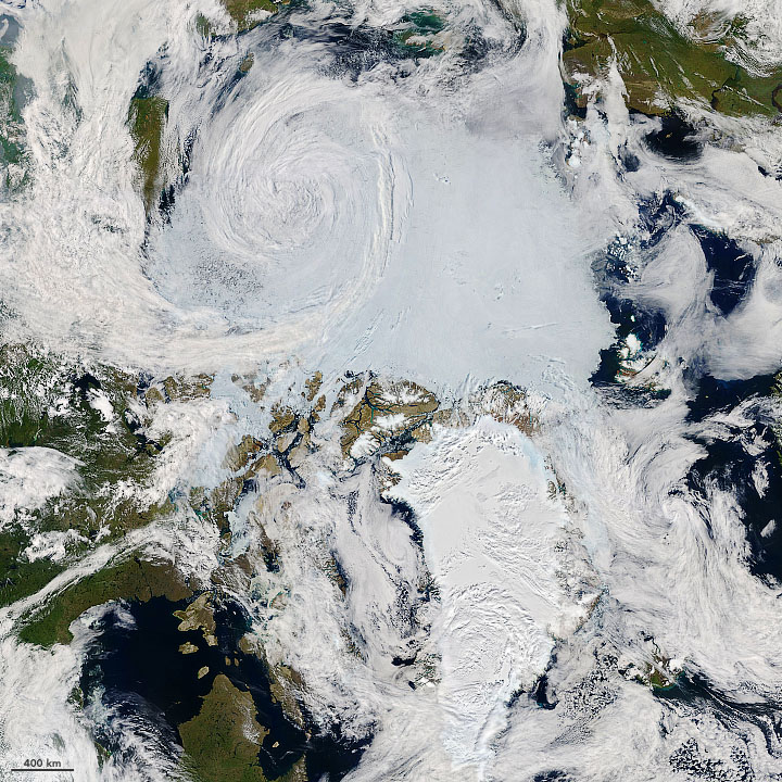
Image Left: Scientists project that sea ice loss and rapidly warming temperatures will cause storms in the far north to intensify by the end of this century. Photo credit NASA, via Visible Earth.
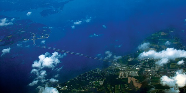
Image (Top of Page): Abundant phytoplankton swirled in the waters off the U.S. Mid-Atlantic coast in spring 2023.Photo credit NASA, via Visible Earth.


