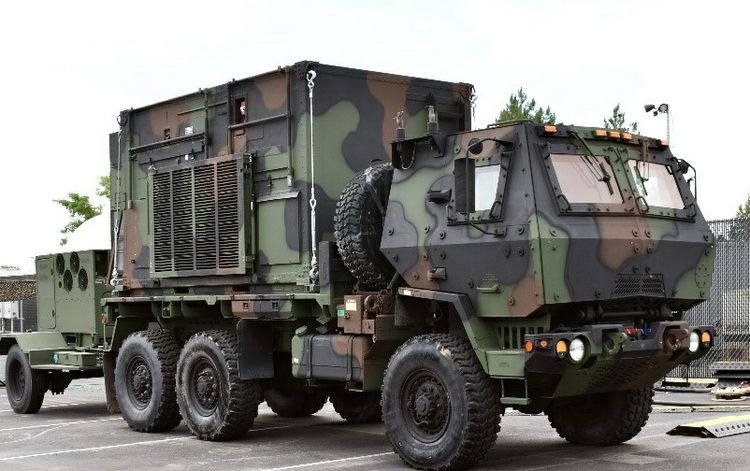
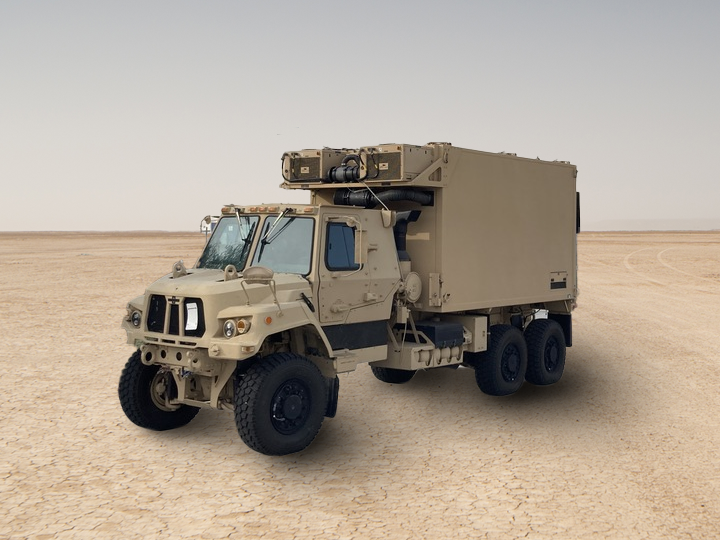
Ground Systems

weather system radar and blue skies

Space Superiority Begins and Ends on the Ground

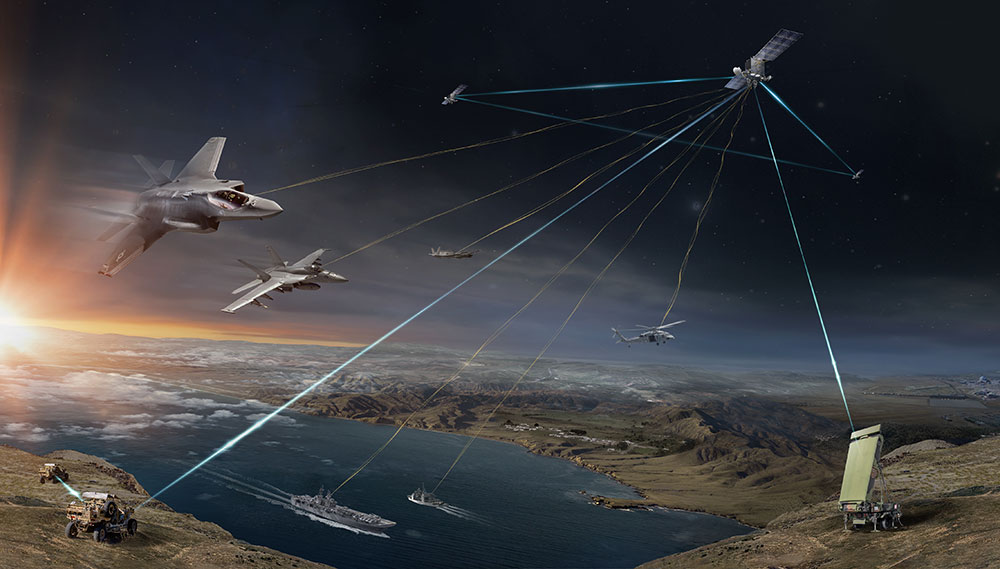
Northrop Grumman continues to push the boundaries to enable a connected future. Our ground system capabilities are connecting all domains from earth to orbit with real-time intelligence for real-time decision-making. We leverage decades of ground systems leadership in mission management and processing, missile warning and tracking, space domain awareness and the tactical edge, bringing extensive mission understanding. Through the demonstration of our end-to-end capabilities—Northrop Grumman is a ground systems provider of choice for critical missions around the globe.

Tactical Edge

Northrop Grumman develops ground-based solutions with the ability to get any data, any place, any time for any mission across the Department of Defense and the intelligence communities. Our JADC2 systems deliver information that enables decision-making for mission specific needs, and our tactical edge product line allows warfighters to be "alone and unafraid" with resiliency in any mission.

military truck in camouflage

Tactical Intelligence Targeting Access Node (TITAN)

Northrop Grumman is supporting the U.S. Army’s Tactical Intelligence Targeting Access Node (TITAN) program, a scalable and expeditionary intelligence ground station that will leverage space, high altitude, aerial and terrestrial layer sensors to provide targetable data to commanders at all levels so they can quickly assess threats.

Pre-prototype

The TITAN pre-prototype is a mobile, semi-autonomous system that leverages commercial and military space assets to facilitate deep-sensing, reduce sensor-to shooter timelines and maximize the effectiveness of long-range precision fires.

Read News Release
military truck in sand

Deep Sensing

Partnering with Palantir, Northrop Grumman is also leading design maturation of the TITAN Advanced and Basic vehicle shelters leveraging its capabilities in complex, forward-deployed ground systems to provide actionable targeting information for enhanced mission and long-range precision fires.

Read News Release
satellite tracking military aircraft, ships and land-based targets

Maritime Targeting Cell (MTC)

Supports the Department of Defense’s strategy for its Joint All-Domain Command and Control (JADC2) mission to conduct multi-domain operations by providing critical data to the frontline.

  • Fully integrates data from multiple assets into a single mobile system.
  • Reduces sensor-to-shooter timelines and maximize the effectiveness of long-range precision fires.
  • Allows for rapid assembly for quick and agile maneuverability with ground forces.
Read News Release

Space Surveillance

At Northrop Grumman, we continue to advance the frontiers of science and technology delivering unmatched space domain awareness, ensuring our customers have the tools they need to meet challenging mission requirements and stay ahead of the threat. We provide the Nation with immense capability to understand what is happening from low Earth orbit to deep space. We execute with speed — accelerating our pace of agile deliveries to worldwide systems, currently sustaining and deploying over 100 space-related radars, sensors and antennas across every continent except Antarctica.

Radar signals beaming down from space to earth

Deep-Space Advanced Radar Capability (DARC)

Ground-based radar that will provide all-weather, 24/7 space domain awareness for the geosynchronous orbit regime 22,000 miles above the equator.

The three DARC sites will detect, track, identify, and characterize orbiting objects to help protect the Nation’s most valued space assets.

Read News Release
radar on top of building

Sustainment and Modification of Radar Sensors (SMORS)

Sustains and modifies a worldwide network of ground-based radars deemed critical to the success of its missile warning/missile defense and space tracking missions. (Image courtesy U.S. Space Force)

Read News Release
woman wearing sunglasses

Environmental Sensing and Analysis

Ionospheric Ground System (IGS) fields and sustain sensors used to monitor the upper atmosphere for potential impacts to military systems.

Read More

WeatherStream/Helios (WxHe) provides enhanced capabilities to improve weather forecasting for deployed forces.

Free Space Optical Communications (FSOC) supports NASA with atmospheric monitoring, analysis, and prediction in support of future advanced communications systems.

Mission Management

Northrop Grumman leverages decades of advanced ground system and payload leadership to deliver mission capability inside adversaries' decision loops. Our goal is to simplify the experience, improve usability of existing systems and ensure full adoption of new mission capabilities. We bring extensive mission understanding to architect and deliver modular open system designs affordably. We are focused on lower-risk program execution from development through sustainment with an eye toward our customer’s dynamic mission needs.

rendering of several satillites in orbit

Tranche Programs

Northrop Grumman is providing the ground system support for all Northrop Grumman Tranche programs.


Tranche 1 Transport Layer (T1TL)

T1TL is part of the Space Development Agency’s low-earth orbit network designed to communicate vital information to support U.S. troops on the ground quickly and securely.

The T1TL network will deliver persistent, secure connectivity, and serve as a critical element for advancing the U.S. Department of Defense’s vision for Joint All Domain Command and Control.

Read News Release
rendering of satellites in space

Tranche 1 Tracking Layer (T1TRK)

T1TRK’s purpose is to detect, identify and track hypersonic weapons and other advanced missiles from their earliest stages of launch through interception.

Once deployed in 2025, the T1TRK satellites will operate in up to four low-Earth orbital planes, interconnected with T1TL satellites. Each will feature a wide field-of-view infrared sensor, three optical communications terminals, and a Ka-band payload for communications.

Read News Release
Tranche 2 Transport Layer-Beta Data Transport Satellites

Tranche 2 Transport Layer (T2TL)

Northrop Grumman will design and build 36 satellites for the Tranche 2 Transport Layer (T2TL) – Beta variant prototype constellation which will form the foundation of Tranche 2 of the Proliferated Warfighter Space Architecture.

The T2TL – Beta space vehicles will provide global communications access and deliver persistent global encrypted connectivity to support missions like beyond line of sight targeting and missile warning and missile tracking of advance missile threats.

Read News Release
Submarine Surfaces through Arctic Ice

Enhanced Polar System – Recapitalization Control and Planning Segment (EPS-R CAPS)

EPS system provides continuous coverage in the polar region for secure, jam-resistant, strategic and tactical communications to support peacetime, contingency, homeland defense, humanitarian assistance and wartime operations.

CAPS provides execution of essential mission functions required for military tactical and strategic forces and other users for operations around the northern polar regions including telemetry and control, mission planning and cryptographic planning. (U.S. Navy photo by Mass Communication 2nd Class Michael H. Lee)

Read News Release

Missile Warning & Tracking

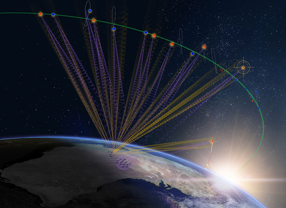
Northrop Grumman provides the most accurate, sophisticated overhead persistent infrared (OPIR) spaced-based global surveillance systems. Its relay ground stations support legacy and future missile-launch and missile-warning detection satellites in addition to mission-critical capabilities for ground stations. Our engineers, analysts and leaders are defining possible while protecting our nation against ever-evolving threats. We have a proud history of supporting national defense — and, through the decades, innovation has been our only constant. 

Learn More
Missile Warning Satellites in Guam

Relay Ground Station – Asia (RGS-A)

Relay Ground Station – Asia (RGS-A) will enable the U.S. Naval Information Warfare Center (NICW) Pacific on behalf of the Space Systems Command to support the operation of legacy and future missile-warning satellites in geosynchronous orbit.

RGS-As will help the U.S. Space Force’s mission to revolutionize existing missile-warning and missile-defense systems with the Future Operationally Resilient Ground Evolution (FORGE) system.

Read News Release
dark room with many techicians computers viewing large screen in foreground

False Track Reduction Machine Learning

Northrop Grumman is addressing one of the Space Force’s top priorities assessing thousands of emerging threats in space each month. This concept leverages machine-learning technology and operational data archives Space-Based Infrared Systems (SBIRS) historical real and false track data to reduce current false track rates by 70 percent.

A panel chaired by Lt. General Michael A. Guetlein, first commander, Space Systems Command, selected this project as the winner out of more than 80 entries. This will be one of the most impactful operator-focused solutions the missile-warning system has seen in more than 20 years.

Read More (Source: Space Systems Command)

Mission Data Processing

Northrop Grumman has been a thought leader and trusted partner in the mission processing domain for decades, and we continue to lead the industry as “ground” transitions to “anywhere” processing. We provide real-time battlespace situational awareness to U.S. and allied forces and national decision-makers through critical, real-time mission data processing. We invest in modernizing our software baselines to optimize deployment flexibility, maintenance costs, and mission effectiveness in a rapidly changing environment.

Grounds Systems in the News

Read all about Grounds Systems in the News
military vehicle truck on desert floor

Northrop Grumman Partners to Advance Deep Sensing for the US Army

Missile Warning Satellites in Guam

Northrop Grumman’s Rapid Completion of Critical Design Review Supports Future Missile Warning Satellites in Pacific Region